
|
When I was making preparations to chase this morning I said to my Dog Rua, who has been chasing with me the last two weeks, that the goal today was to capture a photogenic funnel cloud, waterspout or tornado, I even said Lough Neagh, I was putting it out to the universe but wasn't actually expecting it to happen for real, especially the latter. I always knew that if I kept chasing and never gave up and stayed passionate and optimistic then I might some day catch a rare tornado in N. Ireland, it was one of my dreams however for some reason that dream always seemed far off in the future. August has turned out to be an exceptional time for convective weather after weeks of high pressure and a record breaking heat wave which I detailed in my last chase report.
Nature always seems to find a way to balance itself, after a month or more of almost drought conditions low pressure returned for August and brought with it a very unsettled pattern. The culprit was a low pressure system which seemed to remain anchored with little in the way of eastward motion (no jet stream over us) so the low rotated slowly over the UK for days on end bringing with it a series of fronts and troughs, as a result we ended up with a week or more of convective outlooks being issued for N. Ireland. I chased almost every single one of these outlooks or at least the forecasts which looked more promising, the highlight was the chase between Portglenone with Nigel McFarland and Colleen Webb when we intercepted several thunderstorms and captured a huge shelf cloud which was the best I've seen since 2009. The following day I did a solo chase all day under intense high precipitation cells over the Mid-Ulster area, that day began promising but quickly went downhill when cells merged to give a day of heavy messy rain. The day after that I met up with Paul Martin and we spent the entire day chasing and it too turned into a wet mess. Paul and I were so frustrated that day, the amount of miles we covered back and fourth across the country with not one image to show for it, by 18.00 on the Sperrins we pulled over and called it a bust. We had not been dry once, just constant rain, even from clouds which didn't even look capable of rain, well they were raining too. We were beat and exhausted but we agreed we had done our best and that nature now owed us one.
August 9th looked to be the last set-up for a while so the pressure was on to catch something dramatic before the season ended, I had put all my hopes on this day, in truth I really wanted to catch another funnel cloud, I was happy with the funnel I had captured from Slaughtneil from earlier in the season however I wanted another one, I don't know what it is about funnel clouds but I've always been obsessed with them, ever since the big one back on July 17th 2007 I knew my life had changed, the hunt for funnel clouds and tornados in N. Ireland had become one of my life long goals and I've been doing this ever since. I've seen many funnel clouds since then of various shapes and sizes and despite seeing some beauties, one of which may or may not have been a touch down, I had yet to see one anywhere near the caliber of the 2007 funnel, which incidentally enough was over Ardboe near the shore of Lough Neagh. I still believe that funnel was a tornado based on the visual sight however there was no way to prove it. Since that experience I've researched funnel and tornado activity across Ireland extensively and have noted the high frequency of such incidents within the Lough Neagh basin and I always pondered why.
Perhaps its the flat surface allowing wind to do its thing unimpeded or the lough's own micro climate has a role to play, maybe it's the effect of differential heating aiding with thermals and vortices or the abundance of moisture helping storms to feed. Whatever the case Lough Neagh and the surrounding countryside is our version of Tornado Alley in N. Ireland. This outlook actually looked promising and I had discussed it at length with the guys, we studied every model we could get to make an informed decision about a target area. The set-up was 800-1000j/kg of CAPE, LIs-3, a slack NWly flow, -40c air aloft at cloud top level but no wind shear at all. The main threat was for slow moving showers and storms with spot flooding so the Met Office had issued a yellow warning. ESTOFEX had went with a level 1 for excessive precipitation and type II tornadoes. Tony Gilbert from UKweatherworld had also placed an experimental box around the Lough Neagh basin for funnel clouds and tornadoes from convergence zones, I always get excited when I see an outlook from Tony for it was he who had forecast the big funnel of 2007.
Our main conclusion was that storms would be slow moving, less than 6mph forward speed, easy to chase, but could be messy, however I wasn't interested in thunder, I was after a funnel cloud or better. I did notice weak convergence near the lough and the AROME model, which had been fairly accurate every day, was keen on several areas of interest such as NW of the Lough, W of the Lough and then S and SE of the Lough into Co. Armagh and border areas. Cells looked to fire further N over the high ground of the Sperrins then move SE inland. My plan was to get on any cells near the lough then follow the activity SE, I fully intended to chase to Co. Armagh or Keady.
By late morning the outlook was still valid and I was starting to get a good feeling. The cloud was breaking and patches of blue sky appeared and the sun began to get to work, also the humidity was increasing with time and soon it was very warm. I spotted two fairly large towers to my S by 11.30 so my chase began early. They had big tops and low dark bases so I packed all the gear into the van and Rhua and I went chasing for the day. The chase got off to an intense start, I went through the old Coagh road outside Cookstown and I was already getting frustrated by other drivers, that road is very narrow in places and busy so when you meet oncoming traffic it can be a tight fit to pass without incident which meant that both parties had to move to the sides to allow safe passage. Well, I had done my part but it seemed other drivers didn't seem to care and dominated the road so I ended up having branches and hedges scrapping against my wing mirror and side panels and several times I ended up on very rough grass verges to take evasive action, I fully expected to have a blow out and had only recently bought two new tires so my temper was starting to go. Then I took minor roads in the direction of the cells to get off the main route, this turned into a maze of back roads and hills and dips, passing gorgeous fields with bales of hay, the countryside was looking gorgeous, I had to admit that storms or no storms I really loved doing this.
I got under the dark base and it fell apart, I realized I had been trying too hard too soon and had got myself worked up, I just needed to calm down and re-think my plan but stay in the target area. I then drove to Coagh and took Rhua out for a walk, the weather was gorgeous with blazing sunshine and blue skies, for the first time in days we had very strong solar heating, this was bound to get convection going. I bought some warm food and drink and ate a snack down by the local river while monitoring the sky. I noticed that the clouds were terrible, small mushy towers and nothing really happening, not even a shower falling, it looked like a cap was the culprit, so on a whim I drove to Ballyronan Marina to watch the sky and walk Rhua once more. After an hour I noticed more agitated towers to the S of the lough which were the best looking sight in the sky, so I followed the lough S and found a new base at Ardboe Cross, where I took Roisin and our first date. I spent two hours at the rear of the graveyard watching over the lough, I did see a line of convection to the S and SE which was really trying with soft anvils but again everything looked messy and devoid of life. Later a guy called Christopher arrived who happened to follow me on social media and we ended up chatting about the potential, I also ended up learning some new historical information about the area, thanks Chris.
After Chris left convection began to ramp up everywhere, towers where getting bigger and more solid across the lough, I watched two cells boiling in the heat, they were actually looking great, the sun was that strong I was actually getting a tan from watching convection, something told me to stay here and time lapse these growing cells but I didn't listen, I saw big towers to the SW inland dropping rain so they lured me away from the lough. Then I got a text message from Paul Martin saying he had just got thunder and a funnel cloud from near the border, I couldn't believe it, I was excited to hear this news, the cap was breaking and funnel clouds were forming, I was delighted for Paul for after our last chase he deserved to catch another funnel after all the dedication he put in. That news got my adrenaline going, it was now mid to late afternoon so I hit the road with intent and began chasing inland cells.
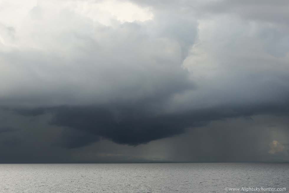
I got snookered on back roads near the Washing Bay area and couldn't get near the lough at all, I hit dead ends and curved back roads which seemed to take me around in circles getting nowhere. I ended up chasing cells everywhere, Brockagh, Newmills, Coalisland, Moy, Benburp, N. Armagh, Eglish, Dungannon then Castlecaulfield, and no matter where I went I was just getting under rain and lifeless clouds, I felt like I had been driving for hours and time was running out, it was already 17.00 and we had passed prime solar heating and I already had come to the fact that this chase was another bust. However as I drove all I could see was absolutely amazing convection across Lough Neagh to the E and SE, those vary same cells I had been watching from Ardboe were now awesome sights, they seemed to stay there for a very long time in full sunshine, their tops and updraughts rock solid and boiling, I had made one of the biggest errors, I should have stuck with my cell and remained patient, if I had stayed at Ardboe I would have got a front row seat across the lough and would have ended up getting my best time lapse of the season.
I now felt exhausted and defeated, the constant driving yet again for the third day in a row was taking its tole so I decided I would head back N and make my way home. Then as I entered Cookstown I got stuck in slow moving traffic on the Dungannon roundabout side, at this stage I just wanted to go home. It was then that I spotted two incredible cells on the other side of Cookstown, I was actually in shock, they looked like atmospheric bombs going off in the evening sunshine towering high into the sky, it was then that Nigel McFarland rang to give an update on the radar. Storms galore S of Armagh and border but quiet in the N, I mentioned the towers I was seeing and Nigel said they were growing on radar, but what I was seeing was so spectacular I don't think the radar was even showing these updraughts yet, to me they looked like storms about to explode, I was beat though and just left it in the hands of fate so I asked Nigel what do you think I should do? and Nigel replied ''what are you waiting around for?, go and chase them!'', so I dropped Rhua off at the house, did a radar check, got a drink which took me 15 minutes then I went back on the road chasing hard.
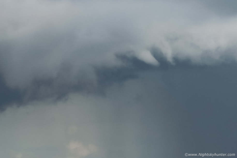
I was back on the old Coagh road again getting my wing mirrors battered by hedges and driving swiftly NW towards what I considerd to be the most spectacular cells I had seen all day. I made a beeline N to NE visually following the convection, I was back in the zone in combat mode and had an instinct something was going to happen. I suddenly rose over a hill and saw the base of the flanking area updraught and was absolutely floored to see the best funnel of my life, I actually did a double take as I couldn't believe what I was seeing, to my 10 o clock position was a massive white stove pipe and in that split second I knew that this was a tornado. The view presented in front of me was a sight I shall never forget, it looked like something straight from Tornado Alley in the USA. What I saw was a brilliant white well defined stove pipe tornado seemingly close to the ground or perhaps on the ground, the tornado was appearing and disappearing as trees and branches passed between us as I drove but in the gaps the sight was unmistakable. The stove pipe was broad where it blended in with the base and gradually became slender and tapered at the snout, not to a point but to a large rounded form, the funnel itself was pointing straight down in a vertical orientation and looked like a thick cylinder, the visibility was excellent, the tornado was in full sunshine and connected to a large well defined base and above this unforgettable sight was en enormous updraught exploding aloft, the entire scene was simply epic, the time was almost 18.00 BST.
This was the moment I had been waiting for, the moment I had dreamed about, my dream tornado image from N. Ireland was actually happening rite now then the panic and horror struck me that I was still driving and had no images, it was like the anxiety nightmares I get when I see a tornado and something goes wrong or I freeze or my camera stops working. I had to do a quick mental calculation within seconds factoring in my position and the terrain ahead or I would never get an image or even loose it front sight. There was a car close behind me so I couldn't slam on the breaks and already I was descending down the other side of the hill and lost it from view, I came to a T-junction and stopped, my next move could make or break this chase. To the right was the road to Ballyronan Marina where I was intending to go, but that road lowered down into dips with trees blocking the sky, that wasn't an option, so I took the left option then immediately pulled over onto a grass verge.
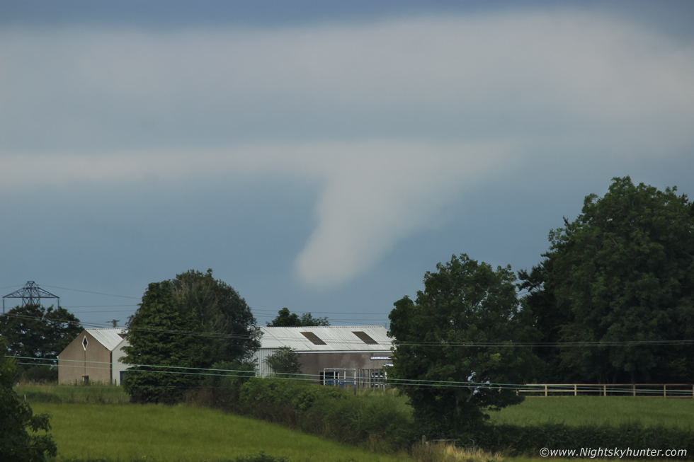 |
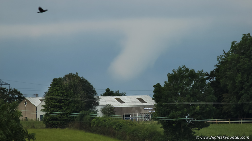
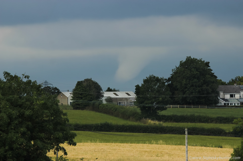
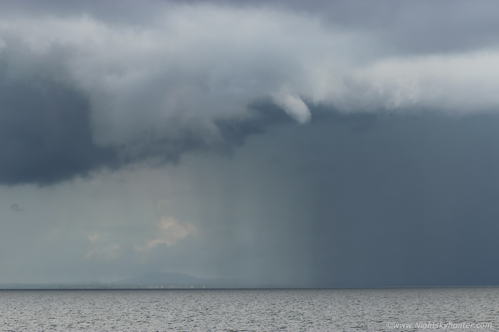
I never felt so focused in all my life, adrenaline was soaring through my body, by the time it took me to open the rear doors of the van, attach the 100-400mm lens and get focused and settings selected felt like slow motion as if 20 minutes had passed but in reality it may only have been 40-50 seconds. I could just glimpse the tornado through gaps in the trees across the fields but horizon obstructions were blocking its full splendor. The funnel was already lifting back up into the base and slanting over at an angle and less well defined. Using the 100-400mm these images were all I got of this amazing sight. Even with the most photogenic phase missed you can still appreciate the girth of this vortex.
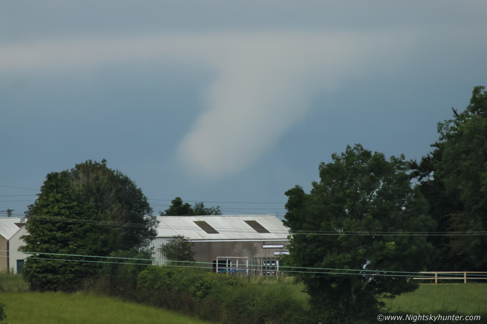 |
Keep in mind that one minute before this the funnel was a straight stove pipe going all the way down to the horizon, I reckon I was 7 or 8 km away as the crow flies.
 |
I won't lie to you that my hands were shaking when I was taking these images, I felt like I was hit by a wall of emotions and frozen to the spot, such was the impact of the scene that I almost forgot how to do photography, my brain struggled to process simple information like getting the correct shutter speed and aperture to expose the scene, I was switching fast between settings taking shot after shot, some of the images turned out blurred from hand shake.
 |
Then one of my nightmares came true, suddenly the screen on my camera turned black and I couldn't preview my images and when I tried to adjust settings the numbers on the LCD froze and wouldn't move, I cursed and cursed in a panic, why would my camera decide to pack in now at this precise moment? I couldn't make this up. I tried to remain calm and switched the camera off, removed the lens, re-attached it again and powered it back on and this time it worked, I then backed up into a field on slightly higher ground for another image, the funnel retracted back up into the base and vanished. The entire period from when I first saw it while driving to taking these images seemed like the blink of an eye, I had lost all track of time. I was delighted I got some kind of record of it but also felt distraught and almost in tears that I couldn't get stopped to capture it at its mature phase. When you look at the base above the funnel in these images it looks like flat cloud, but this was in fact a small section of the huge base, far above the camera view where two massive updraughts, the sight alone of this convection would have been enough to make my day even without the tornado, the entire visual scene was a dream come true but I can only describe this in words to help paint the bigger picture as images don't do it justice, if you could have been beside me when the strove pipe came into view I know you would be beside yourself with shock and awe just as I was, I was actually thinking of Conor McDonald at this time and how he would have absolutely loved this, I can only imagine his reaction.
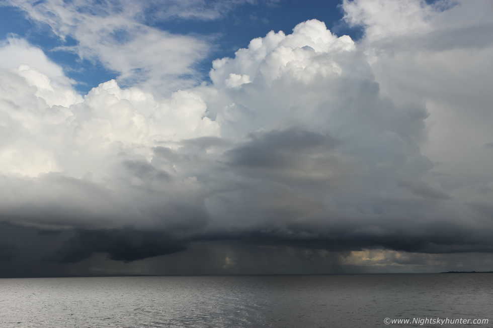
The chase was far from over, those cells which spawned the funnel were still growing so I drove on, I passed through a heavy core of rain then emerged out the other side, when I did I was back under dry clear skies and perfect visibility and once again I could see those two cloud bombs expanding in front of me, I didn't know where I was going so I just chased in that general direction. I ended up driving at swift speed along country roads, rounding bends, climbing hills and dropping into dips, passing trees and fields as the battle continued to find a decent view. I was on Carraloan Rd, Loves Rd, Auhgrim Rd then Ballyronan Rd and by pure chance ended up at Ballyronan Marina, as I drove into the car park the towers were dominating the sky over Lough Neagh in perfect view.
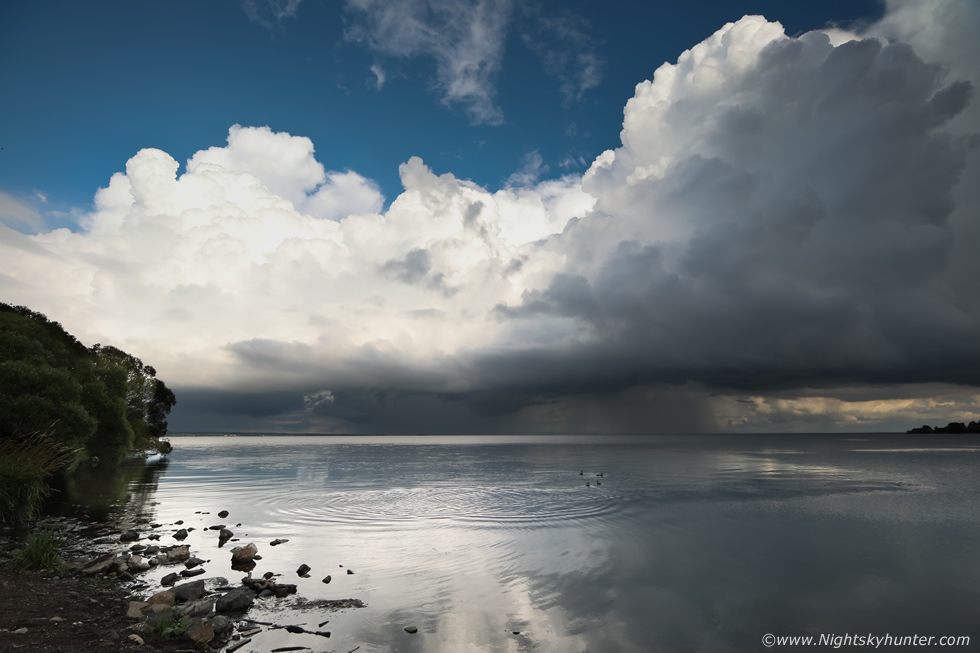 |
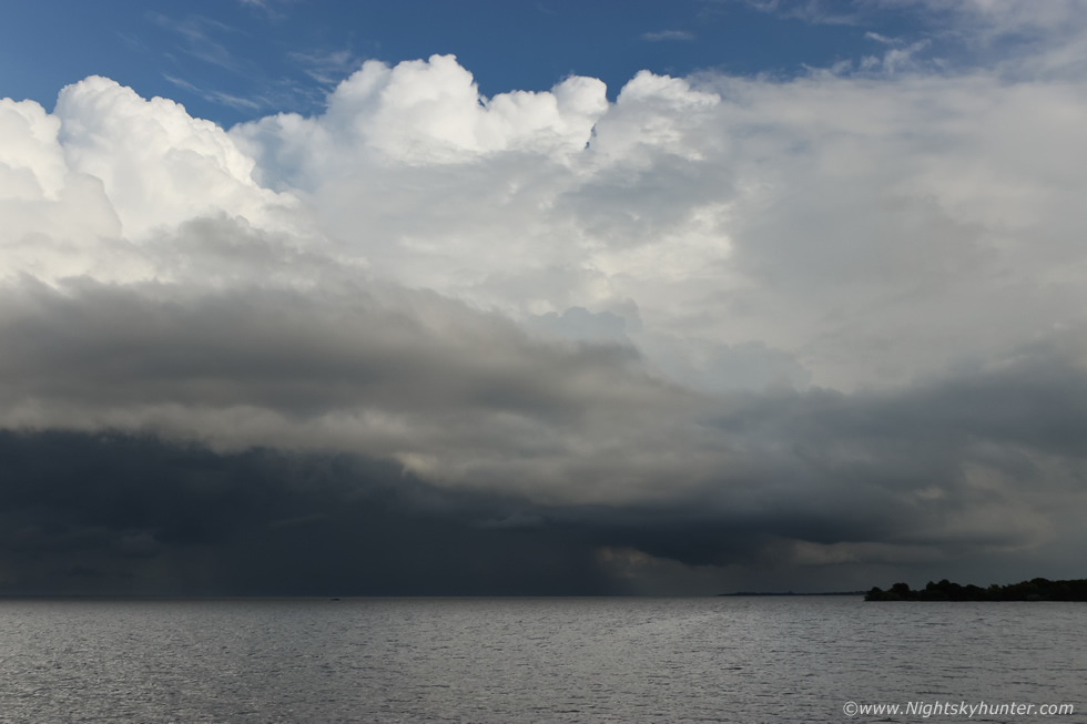
I parked, grabbed both camera bags and 100-400mm lens and rushed out onto the shore and took this super wide angle image at 15mm of the storm clouds over the Lough with the 5D. The white convection to the left was the cell which dropped the tornado, it had now moved further away to the SE towards Antrim while a new large updraught had took charge to the right.
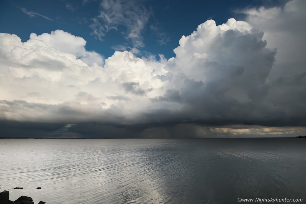 |
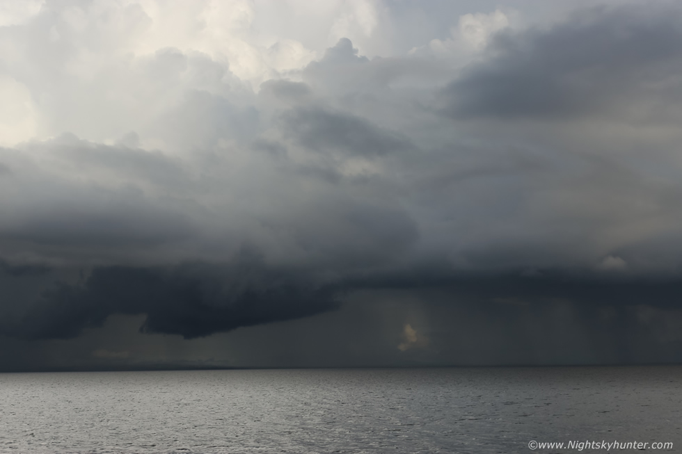
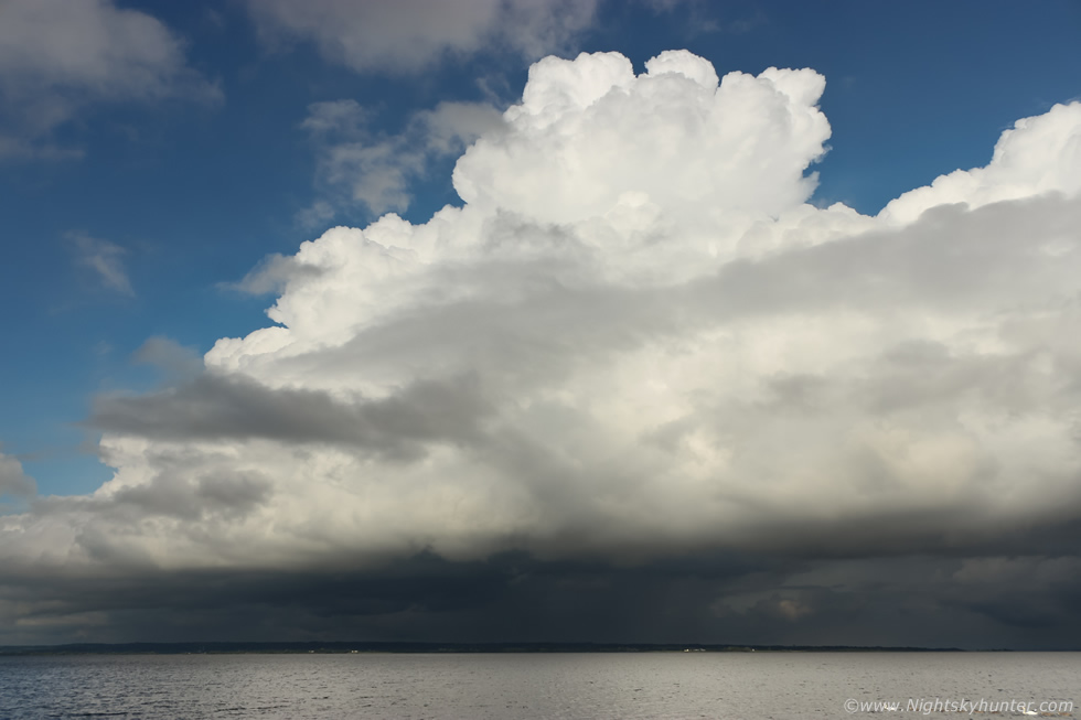
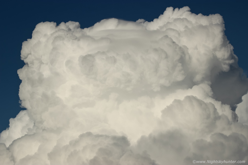
My mad dash to the water with all the camera gear had drawn attention from some of the walkers who had noticed my interest in the clouds. Some of them said the clouds were amazing, I asked them did they see the funnel? and they replied that indeed they had and that it was over the northern end of the lough in the direction of Toome, they suggested trying the new look out platform recently built over the water as a good place to watch. Considering the caliber of the convection I was anticipating that another funnel could be possible so I was on high alert, this was the first time in years since I've seen dramatic storm clouds over Lough Neagh at Ballyronan, the last was 2010 when I watched a multicell thunderstorm with my Mum rumbling away which was dropping large hail over Antrim on the other side of the lough, it felt wonderful to experience storm clouds here again, I decided I was going to enjoy these and spent the rest of the evening there. One more 15mm wide angle shot, keep in mind that in reality these towers were massive, solid and high, the sun lit up their white cauliflower tops and the base was dark and mean, precip had broke out at centre and off frame to the right, amazingly there wasn't a single rumble of thunder.
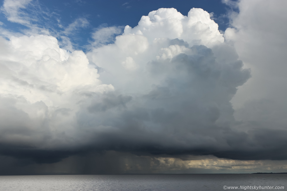 |
I then got set-up on the new viewing area where I spent the next hour and a half shooting these updraughts. The 18mm lens on the 600D was doing their size better justice.
 |
I was still buzzing from all the recent excitement and felt that wonderful glow one gets when they witness something rare and special from nature, I was in my element here, in a t-shirt, warm, sunshine on my face while watching big storm clouds brewing over the calm lough on a tranquil evening, it was hard to believe I had seen a stove pipe tornado only 20 minutes ago. I noticed a lowering under the dark base left of centre and was keeping an eye on it.
 |
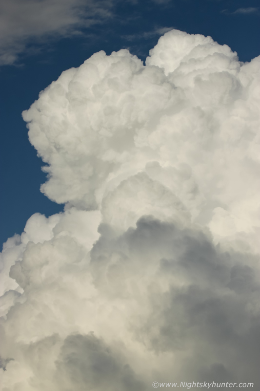
That base looked quite swollen and rounded, I began talking to myself saying please give me another funnel cloud or waterspout over the lough, I was actually talking to myself out loud then caught on I was in a public area with people walking past and felt a little foolish.
 |
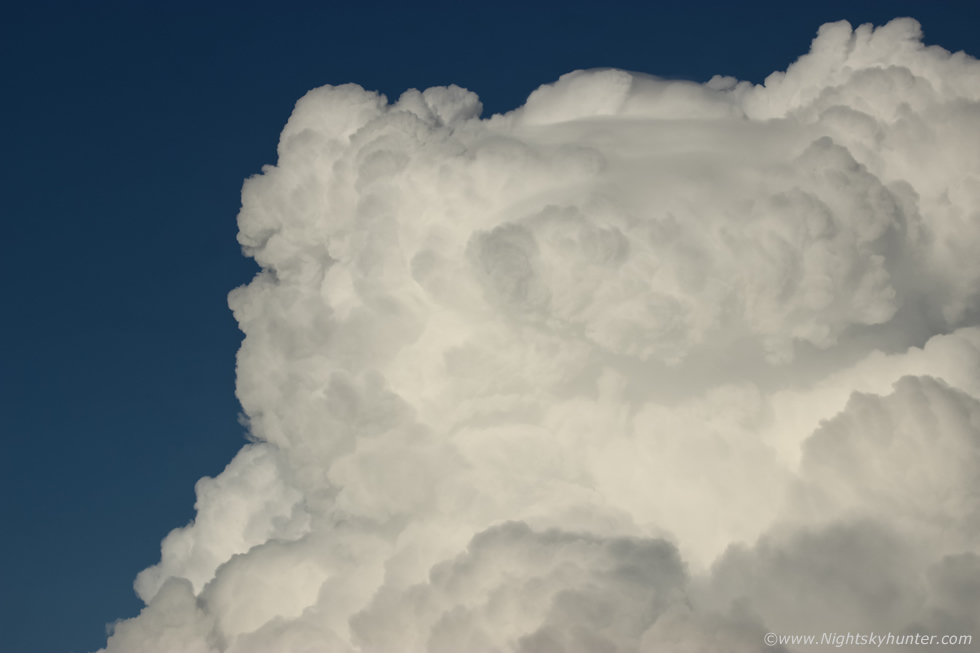
Wider view of the updraughts and base, moving very slowly from left to right and slightly away from the camera, the flow was NWly so the cells were moving to the SE. An elderly couple stopped to talk with me and commented on the amazing storm clouds, it seems many were impressed by the clouds over the lough. For those that don't know it's these kind of clouds which produce funnels and tornadoes, the Cumulus Congestus (Towering Cumulus), Cumulonimbus Calvus, Cumulonimbus Capillatus and Cumulonimbus Incus.
 |
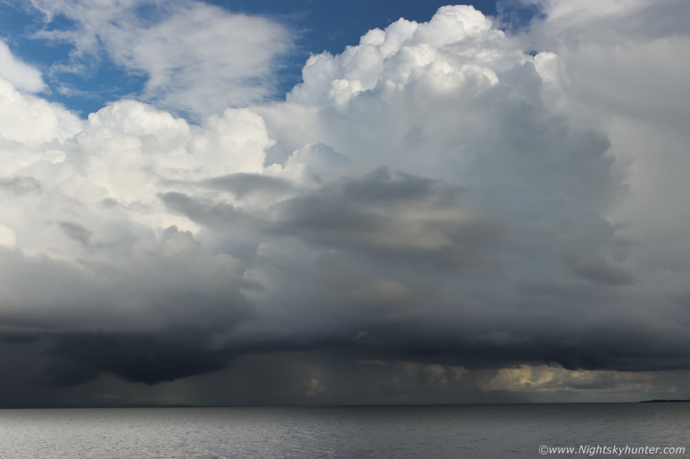
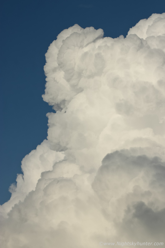
That lowering had got interesting, abrupt and well defined, the rear side was tilted towards the precip core on the left suggestive of a wall cloud but I'm not sure on this, the forward slide is slanted upward at an angle indicating it was being undercut by rain cooled air, it may be an outflow feature, it sometimes can be difficult to tell when two cells are so close in a line.
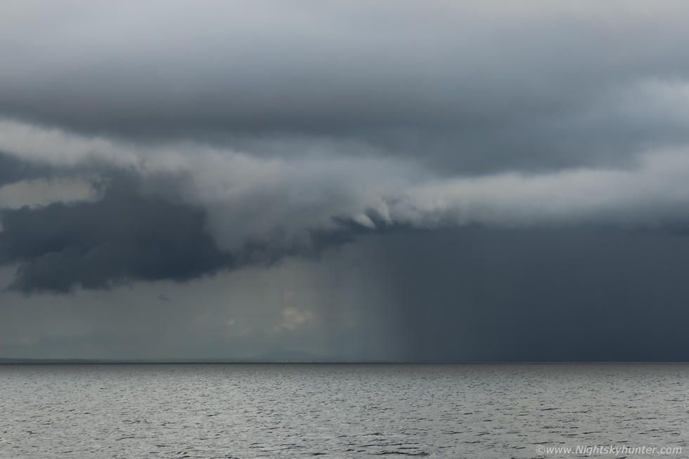 |
The lowering behaved itself but the edge of the cloud base produced a stubby white funnel cloud. I was talking out loud encouraging it to come down lower and touch the water however it stayed at that elevation and never grew longer. Compared the beast I saw earlier it was a sorry sight but I actually really liked it, another surprise from nature and only 30 minutes after the big one, two vortex events captured on the same chase, I will take that.
 |
55mm and slight crop, I could see it rotating and changing shape, that little bit of scud beside it was actually trying to spin too.
 |
Then it vanished, it was in view for perhaps one minute, a fleeting apparition but I at least captured this one at its best. Some of these days I intend on catching a waterspout over the lough in perfect evening light, it will happen sometime, my Cousin captured a touch down at this very same location years ago which turned out to be the most documented tornado captured over Lough Neagh in history.
 |
Panning around to the southern side of the line which was now moving away down the lough. A breeze associated with the outflow was pushing across the lough towards me indicating the core was on a downward phase, however the tops above were still boiling.
 |
Just when I thought the show was over the flanking area came to life as more towers went up, it seemed this area just didn't want to give up, the lowering evening sun was now producing nice contrasty light as updraughts continued to billow skyward, I wasn't for moving an inch, I was committed to the cells and enjoying every second.
 |
Then another updraught went up, the tail end charlie looked stunning with great crisp detail, I watched a Pileus Cap form then the towers punched through it as they ascended. I used the 100-400mm to get in close to these tops, keep in mind these were very tall updraughts and the camera is pointing up at an angle.
 |
Nothing better than watching convection on a warm Summer's evening.
 |
There were two delicate veils of Pileus on this tower, you can see the dome of the upraught pushing through the one on the far side.
 |
Last shot of the evening, then I just stood and watched the calm water in the sunshine then made my way home at a much slower calmer pace. I was fully expecting to see social media full of images and reports of that suspected tornado but to my surprise I never saw a single one. I posted on my facebook page and eventually several eye witnesses commented, they had phone video of the dissipitating stage of the funnel rotating above their homes at close range which was fantastic, however it seemed no one got images of the stove pipe stage. However the most important comment of all was from a lady in Toome who said she saw the whole thing rite over her house, she had no images, however she stated that football nets had blew over along with other debris in the garden which confirmed that there was indeed a ground circulation on the surface which confirmed that this was indeed a tornado. By all accounts it wasn't severe at ground level however it was still a tornado nonetheless at a rating of EF0 on the Enhanced Fujita Scale with wind strength in the 65mph to 80mph range, or T0 on the TORRO Tornado Intensity Scale with wind in the 39mph to 54mph range. I did report the sighting to TORRO for the record.
So this was my first confirmed tornado in N. Ireland, I have achieved my goal of witnessing our capturing this rare event. I was chatting with Conor McDonald about when we first began shooting storms and hunting for these things, we agreed that July 16th 2007 was our first chase in a car and since then we have never stopped, so that's been a relentless hunt for tornadoes during all seasons for 14 years, however we actually began photography of the weather since 2005 or earlier so if you factor that period in then you could say this has been a 16 year quest. I have to say it feels extremely rewarding and gratifying to finally see what you set out to do, I've always said that if you remain passionate and dedicated and never ever give up then nature will reward you with something special. However my dream box is only half ticked, I saw the perfect tornado, I captured it during its lifting phase but I never got the shot of it when it looked like something from Nebraska so my hunger for that perfect capture of a tornado touching down without obstructions in the foreground continues. I'm confident however that the next tornado won't be so long in the making, my personal convective forecasting has improved so much in recent years, I'm using a wider range of models and I'm getting good real time intel from storm spotters and my instincts and experience have advanced greatly since 2007 so I'm now ready for that next N. Ireland touch down, thanks very much for reading.
Vlog I made that day recorded earlier in the afternoon when I had concerns about the cap then continuing on in the evening after the tornado sighting showing the Go Pro view of the convection then a final vlog from Ballyronan Marina documenting the experience fresh on location.
Martin McKenna
